Home | About
About us
The Canadian Health Care Agency is a provider of high quality nursing services of distinctive value. We specialize in providing this essential service for Indigenous communities across Canada’s north, however you can find our professional staff in any environment that requires nurses who are highly skilled in promoting health and well being.
Our mission is to provide our customers with superior quality nursing services.
We take this mission very seriously, it’s at the core of all that we do.
By fulfilling this mission we are able to achieve our vision of improved health and well being in all of the communities we serve and will serve in the future.
Our guiding principles and values
Our values are at the heart of our actions and of the CHCA approach. We are proud of them and wish to share them with you.
We act in a transparent and honest way. This is essential for us to maintain an exemplary relationship with our resources and employees in order to work together as best we can and achieve our common mission.
CHCA acts in a respectful manner throughout its mission. We take into consideration everyone’s differences, treating people equally, involving them and helping them to develop and excel.
We put ourselves at the disposal of our health care providers to accompany them hand in hand in this adventure and support them in their professional development.
CHCA over the years
Our history
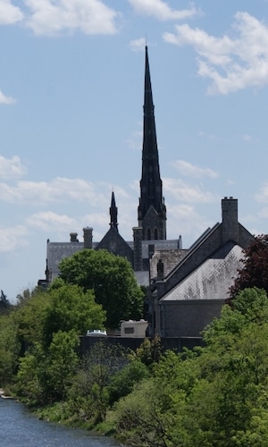
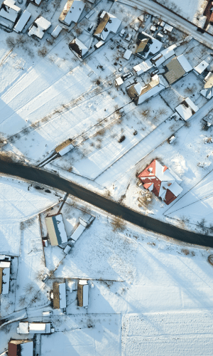
Based in Cambridge Ontario, the Canadian Health Care Agency was founded in 2001 in response to concerns regarding the shortage of nurses in Canada. CHCA specializes in recruiting and training Registered Nurses and Nurse Practitioners to work in remote, isolated and semi-isolated outpost stations, health centers and hospitals in northern Canada.
Foundation
CHCA was founded and started providing services in remote communities in Northern Ontario
1st expansion
CHCA’s 1st expansion was to Nunavut starting Jan 2002
Population & Public Health Branch at the Toronto Pearson Airport
In 2003, we completed a contract during the SARS epidemic with Health Canada: Population & Public Health Branch at the Toronto Pearson Airport with our nurses’ doing assessments & quarantine on international travelers prior to entering Canada.

Awarded a contract with the Government of Northwest Territories.
We were awarded a contract with the Government of Northwest Territories.

Expansion to Manitoba
CHCA expanded to Manitoba in 2009 after being awarded a contract with First Nation and Inuit Health Branch (FNIHB), Western Region
Certified ISO
Since January 2016, CHCA has been successful in obtaining an Excellence in Business Accreditation, and is registered with ISO 2015.
Collaboration with Flu Clinics
Since 2017, CHCA has conducted workplace flu vaccine clinics for corporate clients in Southern Ontario.
Awarded the Primary Provider Contract with Indigenous Services of Canada
CHCA was awarded the Primary Provider Contract with Indigenous Services Canada (ISC) in 2018 for Ontario

Awarded the Primary Provider Contract with ISC
In 2019, a contract for services was signed with the Yukon Hospital Corporation, and CHCA was also awarded contracts as the Indigenous Services Canada Primary Provider in Alberta and back-up provider for Manitoba.
Awarded an ISC Urgent Nursing Services Contract
CHCA was awarded an ISC Urgent Nursing Services Contract in April 2020. It was in this contract that CHCA started to hire & train Registered Practical Nurses (RPN) for the north.
CHCA has been managing COVID swabbing and vaccine clinics for Manufacturing companies in Southern Ontario and major league sports.
Expansion to nothern FNHA communities in BC
Expansion to northern FNHA communities in British Columbia.
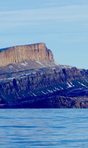
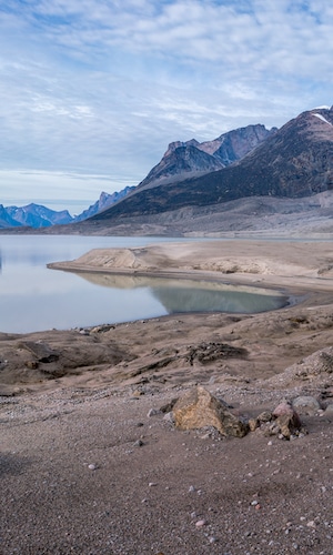
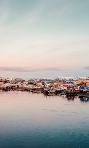
The communities we serve
Present in different regions, our goal is to help multiple northern communities that need our support and health services.
Gitga’at
Gitga’at also known as Hartley Bay is a First Nations community on the coast of British Columbia. The village, which is accessible by boat, is located at the mouth of Douglas Channel, about 630 km north of Vancouver and 145 km south of Prince Rupert.
Gitxaala (Kitkatla)
Gitxaala (Kitkatla) are one of the 14 bands of the Tsimshian nation and inhabit a village, also called Kitkatla – sometimes called Laxklan, on Dolphin Island, a small island next to Porcher Island. The Gitxaala speak the traditional Smal’gax language. In Smal’gax, the Gitxaala people refer to themselves as “Git Lax Moon” meaning “People of the Salt Water”.
Lax-Kw’alaams (Port Simpson)
Lax-Kw’alaams, also known as Port Simpson, is an indigenous village community in British Colombia, near the city of Prince Rupert. Lax-Kw’alaams is a Tsimshian community.
Tahtlan (Telegraph Creek)
The Tahltan First Nation, also known as the Tahltan Indian Band is a band government of the Tahltan people. Their main community and reserves are located at Telegraph Creek. The native language is the Tahltan language, which is an Athabaskan language also known as Nahanni, closely related to Kaska and Dunneza.
Tsay Keh Dene
The Tsay Keh Dene First Nation is one of the Sekani bands of the Northern Interior of British Colombia. Tsay Keh Dene means “People of the Mountain”
Ulkatcho (Anahim Lake)
The Ulkatcho First Nation is a Dakelh First Nations government. Its people are of the Ulkatchot’en ethnic group, a subgroup of the Carrier (Dakelh). Located in Anahim Lake at the western edge of the Chilcotin District.
Bloodvein
The Bloodvein First Nation is a First Nation community located is located 235 km north of Winnipeg and 3 km on the banks of the Miskwewe Ziibi (Bloddvein River). The primary language spoken in Bloodvein River First Nation is Anishinaabemowin (Saulteaux, or Ojibwe) which are part of the Algonquian language family.
Brochet
The community of Brochet is adjacent to the Barren Lands First Nation near the north end of Reindeer Lake. Brochet is approximately 121 km north of Lynn Lake by air and situated on the western edge of the province.
Cross Lake
Cross Lake First Nations is a band of Cree First Nations people and is the principal community of the Pimicikamak indigenous people with the indigenous language of Woods Cree. Situated on the east shore of Cross Lake.
Garden Hill
Garden Hills First Nations is in the northeast on the shore if Island Lake in Manitoba. The primary language is Oji-Cree. Located 610 km northeast of Winnipeg.
God’s Lake Narrows
The Cree name of God’s Lake is Manitou Sakayigun, which means “Lake of the Gods”. The First Nation is a member of the Keewatin Tribal Council. The community is located about 250 km southeast of Thompson, Manitoba.
God’s River
Manto Sipi Cree Nation is a First Nation community located at the mouth of God’s River along the north shoreline of Manitoba’s God’s Lake.
Lac Brochet
Lac Brochet is a Dene Indian reserve of the Northlands Denesuline First Nation, located in the boreal forest of northern Manitoba. It is situated on the north shore of Lac Brochet, 240 km northwest of the city of Thompson.
Little Grand Rapids
Little Grand Rapids First Nation is an inland community situated along the Berens River, with ancestral lands on both sides of the Manitoba-Ontario border. The community is spread out over an eight-kilometre along Family Lake and accessed only by air or winter road. Located 268 air km northeast of Winnipeg.
Nelson House
The Nisichawayasihk Cree Nation formerly the Nelson House First Nation is a Cree First Nations community centered in Nelson House, Manitoba. Located about 80 km west of Thompson. Nisichawayasihk means “where three rivers meet” in Cree and describes Nelson House which is located at the convergence of the Burntwood, Footprint, and Rat Rivers.
Oxford House
Bunibonibee Cree Nation formerly known as Oxford House First Nation and as Oxford House Band of Indians is a First Nation located along the eastern shoreline of Oxford Lake at the headwaters of the Hayes River and is approximately 950 km northeast of Winnipeg.
Pauingassi
Pauingassi First Nation is an inland community with ancestral lands on both sides of the Manitoba-Ontario border. The name Pauingassi refers to nearby sand hills. Situated 280 km northeast of Winnipeg and 13 km north of Little Grand Rapids, on a peninsula jutting southward into Fishing Lake, a tributary of Berens River.
Poplar River
Poplar River First Nation is an Ojibwa First Nations. It is named after the Poplar River, which is the main river on which it resides. Located 450 km from Winnipeg.
Pukatawagan
The Mathias Colomb Cree Nation also known as Mathias Colomb First Nation, Mathias Colomb (Cree) First Nation and Pukatawagan/Mathias Colomb Cree Nation is a remote First Nations community in northern Manitoba, located 210 km north of The Pas and 819 km northwest of Winnipeg.
Red Sucker Lake
Red Sucker Lake is an Oji-Cree First Nation located on a peninsula on the northeast shore of Red Sucker Lake approximately 709 km northeast of Winnipeg. The native language is the Island Lake dialect Oji-Cree.
Shamattawa
The Shamattawa First Nation is a remote First Nations community in northern Manitoba located on the banks of the Gods River where joins as a right tributary. As a remote and isolated community, Shamattawa for part of the year is only connected to the rest of the province by winter and ice roads.
South Indian Lake
O-Pipon-Na-Piwin Cree Nation is a First Nation centred in the settlement of South Indian Lake in Manitoba. South Indian Lake is located on the southeast shores of Southern Indian Lake about 130 km north of the city of Thompson.
Split Lake
Tataskwayak or Split Lake is a community situated on the northern short of Split Lake along the Nelson River about 390 km west southwest of the river’s mouth at Hudson Bay and is within the Tataskweyak Cree Nation reserve.
St. Theresa Point
St. Theresa Point is a First Nation occupies the Reserve area located on the southwestern shore of Island Lake immediately south of the Wasagamack Reserve. Thompson is 350 air km to the northwest and Winnipeg is 600 air km to the southwest.
Tadoule Lake
The people of Tadoule Lake are Chipewyan and are traditionally referred as Sayisi Dene or the “People of the east”. The Sayisi Dene speak the Dene Suline language of the Athabaskan linguistic group. Located 250 km west of Churchill and 332 km to the south of the city of Thompson.
Wasagamack
The Wasagamack First Nation is located on the western shore of Island Lake, about 12 km to the north of St. Theresa Point, 281 km southeast of Thompson, and 607 km northeast of Winnipeg.
York Landing
York Factory First Nation sometimes referred to as York Landing First Nation or York Factory Cree Nation is a First Nations community located along the eastern bank of the Nelson River, roughly halfway between Lake Winnipeg and Hudson Bay , as well as located 116 km from Thompson.
Garden River
Garden River, also known as Garden Creek, is an unincorporated community in northern Alberta, Canada within Wood Buffalo National Park.
It is a First Nations community of the Little Red River Cree Nation
Hay Lake
Hay Lakes is an Indian reserve of the Dene Tha’ First Nations, located within Mackenzie County. It is 100 km northwest of High Level. The village is a quiet community that is home to a population of just over 500 residents who find this community a great place to live.
John D’or
John D’or Prairie First Nations Reserve is located is located 125 km east of High Level. Situated on the Lawrence River, upstream of the Peace River, and south of the Caribou Mountains. The settlement and Indian Reserve are part of the Little Red River Cree Nation.
Fox Lake
Fox Lake First Nation Reserve, Makaso Sakahigan in Cree, is located 180 km east of High Level. The reserve is surrounded by and independent of the Mackenzie Country. Fox Lake had a population of 2,473 in 2021. It is the 13th fastest growing municipality in the province and the primary language is the Cree.
Arctic Bay
Artic Bay is an Inuit hamlet located in the northern part of the Borden Peninsula on Baffin Island in the Qikiqtaaluk Region of Nunavut. The predominant languages are Inuktitut and English.
Cape Dorset
Cape Dorset also known as Kinngait, meaning mountains in Inuktitut is situated on Dorset Island adjacent to Foxe Peninsula at the southwestern tip of Baffin Island.
Clyde River
Clyde River (Inuktitut: Kannigiqtugaapik) is a traditional Inuit community located on the shore of Baffin Island’s Patricia Bay, off Clyde Inlet, am arm of Davis Strait in the Qikiqtaatuk Region of Nunavut.
Grise Fiord
Grise Fiord known in Inuktitut as Aujuittq meaning “Place that never thaws” is an Inuit hamlet on the southern tip of Ellesmere Island in the Qikiqtaaluk Region. It is located 1,160 km north of the Artic Circle and is the northernmost civilian community in Canada.
Hall Beach
Hall Beach also called “Sanirajak” in Inuktitut meaning “The Shore Line” is the oldest known permanently inhabited community existing north of the Artic Circle.
Igloolik
Igloolik spelled “Iglulik” in Inuktitut is located north of the Artic Circle, between the Canadian mainland and Baffin Island, Igloolik is situated on a small island in Foxe Basin just off the northeast corner of Melville Peninsula.
Kimmirut
Kimmirut meaning “The Heel” in Inuktitut is a Inuit hamlet located in the southernmost community on Baffin Island, situated across the Hudson Strait from the mainland of Quebec.
Pangnirtung
Pangnirtung is an Inuit hamlet, in the Qikiqtaaluk Region of the Canadian territory of Nunavut located on Baffin Island. Pangnirtung is situated on a coastal plain at the coast of Pangnirtung Fjord, a fjord which eventually merges with Cumberland Sound. Located 50 km south of the Artic Circle
Pond Inlet
Pond Inlet – Mittimatalik in Inuktitut meaning “The Place where Mittima is buried” is a small, predominantly Inuit community in the Qikiqtaaluk Region of Nunavut, located on the norther Baffin Island.
Qikiqtarjuaq
Qikiqtarjuaq meaning Big Island” in Inuktitut located at the northern entrance to Auyuittuq National Park, Qikiqtarjuaq.
Resolute Bay
Resolute Bay or Qausuittq in Inuktitut meaning “Place with no dawn” is an Inuit hamlet on Cornwallis Island in Nunavut.
Iqaluit
Iqaluit meaning “Place of many fish in Inuktitut is the capital of the Canadian Territory of Nunavut, its largest community and its only city.
Bearskin Lake
Bearskin Lake First nation is an Oji-Cree Frist Nation reserve in Kenora District, Ontario located 425 kilometers (264 miles) north of Sioux Lookout.
Big Trout Lake
Kitchenuhmaykoosib Inninuwug also known as Big Trout Lake is an Oji-Cree First Nation. The community is located about 580 km north of Thunder Bay.
Cat lake
Cat Lake First Nation is an Ojibway Fist Nation reserve approximately 180 km northwest of Sioux Lookout in Northwestern Ontario, located on the central north shore of Cat Lake.
Deer Lake
Deer Lake First Nation is an Oji-Cree First Nations located north of Red Lake. It is part of the Keewaytinook Okimakanak Council and the Nishnawbe Aski Nation.
Fort Hope
Eabametoong also known as Fort Hope or Eabamet Lake is an Ojiwe First Nation in Kenora District. Located on the shore of Eabamet Lake in the Albany River system, the community is located approximately 300 km northeast of Thunder Bay.
Fort Severn
Fort Severn First Nation is a Western Swampy Cree First Nation located on Hudson Bay and is the most northern community in Ontario.
Kasabonika
Kasabonika Lake First Nation is an Oji-Cree First Nation located north of Sioux Lookout. It is part of the Shibogama First Nations Council and the Nishnawbe Aski Nation. Situated approximately 448 km NE of Sioux Lookout on the Asheweig River.
Keewaywin
Keewaywin is a small Oji-Cree First Nation located north of Red Lake. It is connected to south shore of Sandy Lake, 580 km northwest of Thunder Bay. It is part of the Keewaytinook Okimakanak Council and he Nishnawbe Aski Nation.
Landsdown House
Neskantaga First Nation also known as Landsdown House is a remote Oji-Cree First Nation situated along the shore of Attawapiskat Lake in the District of Kenora.
Muskrat Dam
The muskrat Dam Lake First Nation is an Oji-Cree First Nation located in the Kenora District approximately 370 km N of Sioux Lookout on NW shore of Muskrat Dam Lake on the Severn River.
New Osnaburgh
Mishkeegogamang First Nation is in the Kenora District approximately 20 km south of Pickle Lake.
North Spirit Lake
North Spirit Lake First Nation is a small Oji-Cree First Nation reserve in Northern Ontario, located north of Red Lake, Ontario. It is connected to Sandy Lake First Nation and Deer Lake First Nation. It is part of the Keewaytinook Okimakanak Council and the Nishnawbe Aski Nation.
Pikangikum
The Pikangikum First Nation is an Ojibwe First Nation. The main centre is the community of Pikangikum on Pikangikum Lake on the Berens River, part of the Hudson Bay drainage systems, it is approximately 100 km north of the town of Red Lake.
Poplar Hill
Poplar Hill First Nation is an Anishinaabe First Nation located 120 km north of Red Lake near the Ontario – Manitoba border.
Round Lake
North Caribou Lake First Nation or Weagamow First Nation also known as Round Lake Fist Nation is an Oji-Cree First Nations. Located approximately 320 km north of Sioux Loukout.
Sachigo Lake
The Sachigo Lake community is an Oji-Cree First Nation. It is located 425 km north of Sioux Lookout which is the nearest major town.
Sandy Lake
The area know as Sandy Lake is the traditional territory of the Anishinabeck, the Oji-Cree. It is 450 km northeast of Winnipeg, Manitoba, and 600 km northwest on Thunder Bay, Ontario.
Summer Beaver
Summer Beaver is a Nibinamik First Nation. It is 385 km NE of Sioux Lookout, 500 km N of Thunder Bay.
Webequie
Webequie is a growing Ojibway community located on the northern peninsula of Eastwood Island on Winisk Lake, 540 km north of the city of Thunder Bay. Surrounded by Winisk River Provincial Park, Webequie provides tourists a pristine natural landscape with some of the best fishing and hunting in Northern Ontario
Grassy Norrows
Grassy Narrows is one of 28 First Nations within the Grand Council Anishinaabe Nation, it is located less than 100 km downstream from Dryden Mill.
Ogoki
Marten Falls First Nation is an Anishinaabe First Nation reserve in norther Ontario. The first Nation occupies communities on both sides of eh Albany River in Northern Ontario, including Ogoki Post (Ojibwe Ogooking) in the Cochrane and Marten Falls in the Kenora District.
Whitedog
Wabaseemoong Independent Nations or more fully as the Wabaseemoong Independent Nations of One-Man Lake, Swan Lake and Whitedog, is an Ojibway First Nation bank government who resides 120 km northwest of Kenora, Ontario and 13 km east of the Ontario-Manitoba border of northwestern Ontario.
Gull Bay
Kiashke Zaaging Anishinaabek – Gull Bay First Nation is an Ojiibway Nation located on the western shores of Lake Nipigon and the surrounding territory. It is roughly a 200 km drive north from the closest urban city of Thunder Bay.
Kashechewan
The Kashechewan First Nation is a Cree First Nation band located near James Bay in Norther, Ontario. The community is located on the northern shore of the Albany River. Kashechewan First Nation is one of two communities that were established from Old Fort Albany in the 1950’s. The community is connected to other towns along the shore of James Bay by the seasonal ice winter road, linking it to the towns of Attawapiskat, Fort Albany, and Moosonee.
Peawanuck
Peawanuk is an isolated Cree community in the Kenora District, Ontario. It is located near the confluence of the Winisk and Shamattawa rivers, about 35 km from the Winisk River’s end in Hudson’s Bay.
Watson Lake
Watson Lake is a town in Yukon and home to the Liard First Nation, located at mile 635 of the Alaska Highway, near the British Colombia border. The primary language is the Kaska.
Dawson City
Dawson City is home to the Tr’ondëk Hwëch’in First Nation and belongs to the Han linguistic grouping which means “The people of the Klondike River”. It is inextricably linked to the Klondike Gold Rush (1896-99). Its population was 1,577 at the 2021 census, making it the second largest city in the Yukon.
Whitehorse
Whitehorse is a Canadian municipality with the status of city and capital of the Yukon Territory. The 2022 census counted 30,617 residents and the city represents approximately 70% of the Yukon’s population.

Our team
We are a smaller but mighty team!
Travel Coordinator
Schedulers
QA Coordinator
Operations Assistant
Accounting coordinators
Admin Staff
Clinical Educators